Snow over the roof in North Idaho/Northwest Montana?

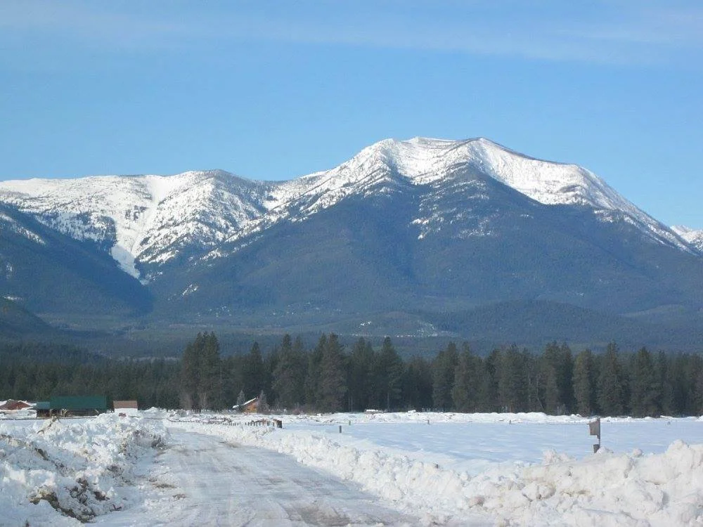
Lake MacDonald in Glacier National Park, MT in winter.
The Northern Rockies region of North Idaho and Northwest Montana are home to some of the most beautiful and rugged terrain in the United States. We are blessed to be able to live in such a beautiful environment here in Bonner and Boundary Counties in North Idaho and Lincoln and Sanders Counties in Northwest Montana. What makes this region so beautiful and heavily forested is the result of a number of factors with the largest factors being precipitation and cloud cover. Anyone who has visited a lot or lived here for a while will tell you that our region sees a lot of cloudy or mostly cloudy days. Where things get a little more interesting and “tall tales” begin to creep in is found in stories told of snowfalls in the area. Having lived in some of the snowiest regions in the lower 48 states and being back in the Northern Rockies since 2007 the writer thought that it may be helpful to straighten out some of the stories of winter nightmares in the region where people live, work and reside. This article aims to help clear up those stories and also present some photographs so that the reader can decide for themselves.
Most locals in the region will tell people, especially those that are new to the area or are thinking about moving to the area that our region sees “ a lot of snow.” The question arises then, what is a lot of snow? For those that are moving or have moved to the region from warmer climates, especially those to the west and south of Northwest Montana/North Idaho our region may very well receive a lot of snow. The definition of a lot of snow can be highly variable and is certainly debatable and up for discussion. From the writers perspective the Northwest Montana/North Idaho region does see a fair amount of snow however where most people reside(with a notable exception of Schweitzer Village above Sandpoint, ID) snowfall amounts are rather tame and easily manageable. For reference this article will focus in on the 2 largest towns in North Idaho/Northwest Montana, those being Sandpoint, ID and Libby, MT although both of these locations will provide a pretty good average of snowfall amounts in the populated areas of our region.
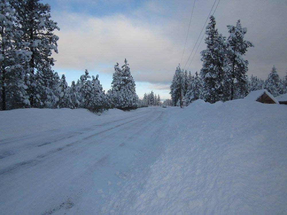
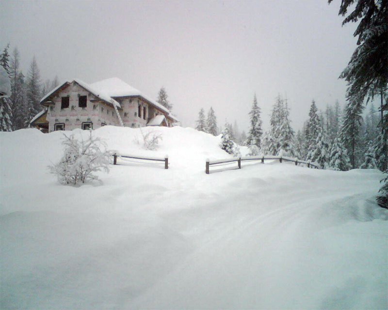
Seasonal snowfall is highly variable each year and depends on a number of factors with the two biggest factors being snow levels and frequency of storm systems. The average annual snowfall in Sandpoint, ID is 70.3 inches and in Libby, MT 65.3 inches (source NOAA CO-OP station data). To put this in perspective those amounts are both less than 6 feet for the entire year. That may still sound like a lot of snow and it is a fair amount but how much of that snow is usually on the ground at any given time? Here are some pictures showing large amounts of snow on the ground.
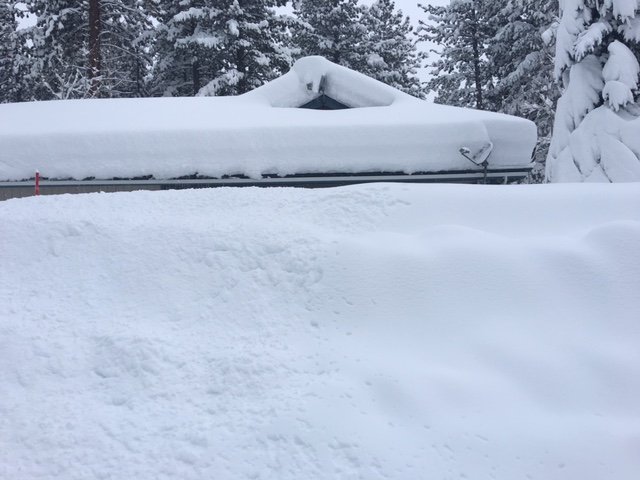
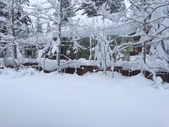
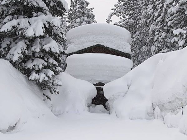
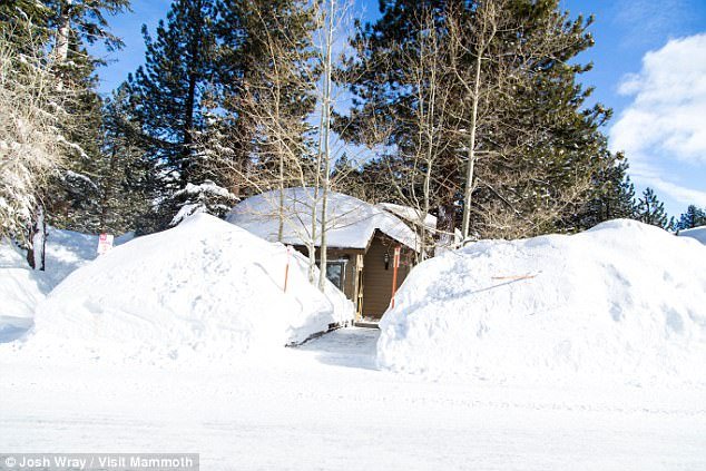
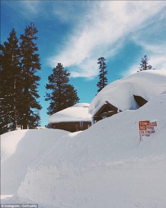
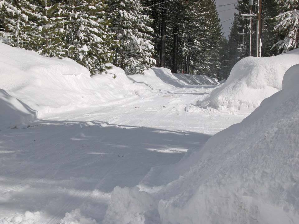
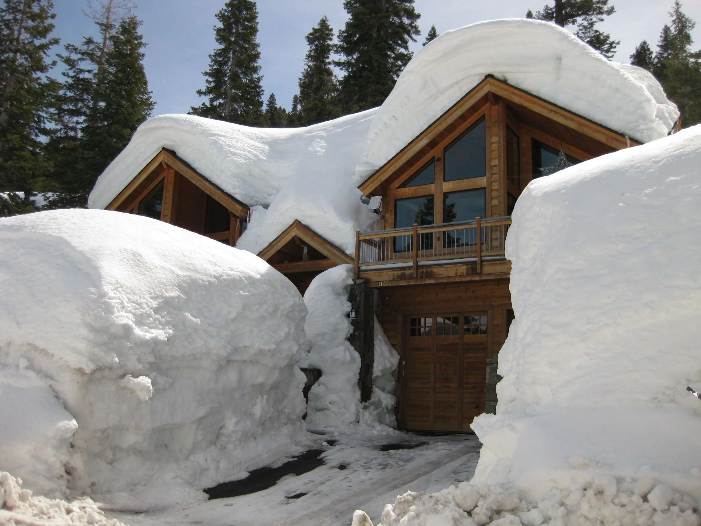
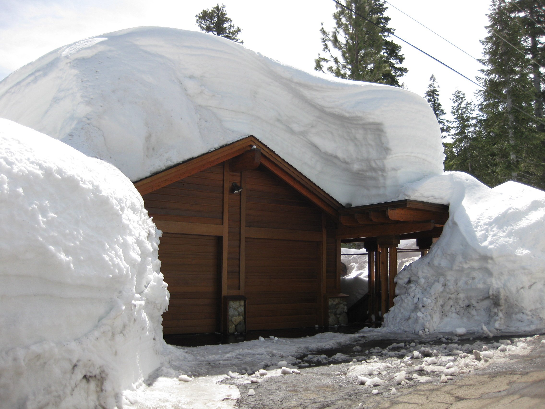
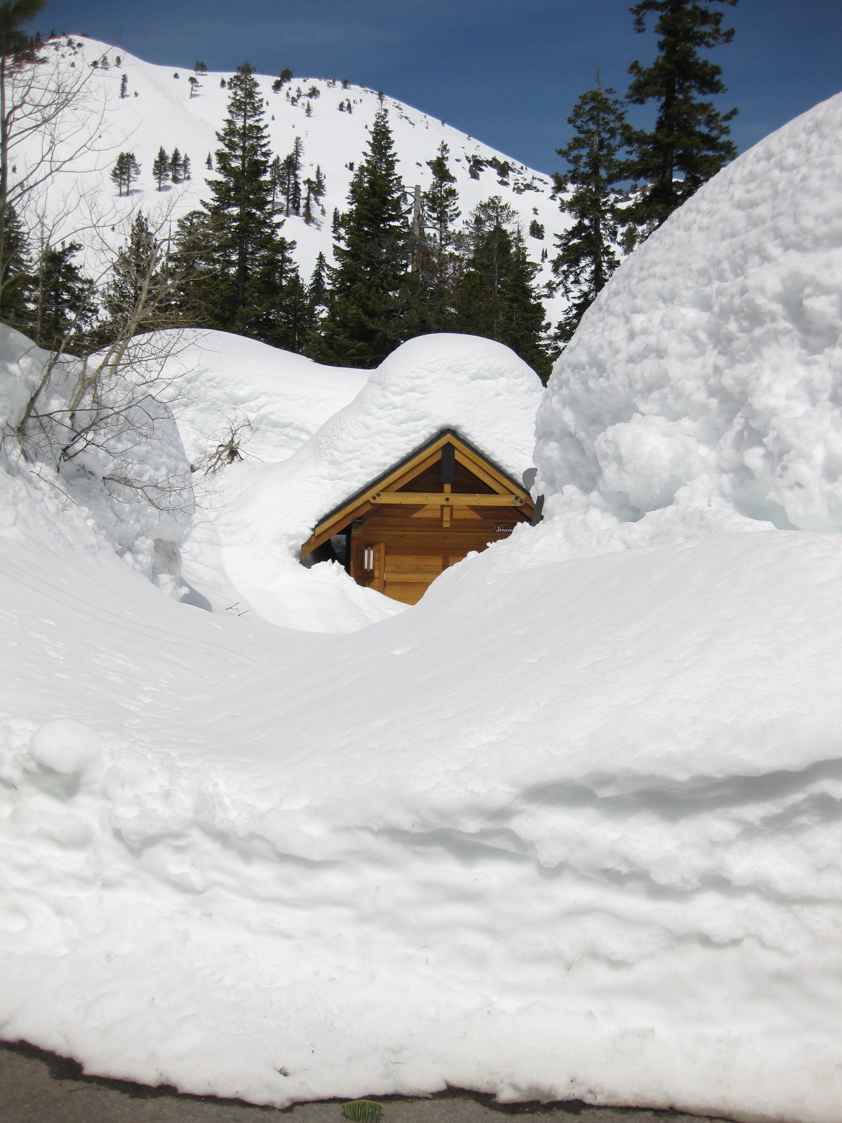
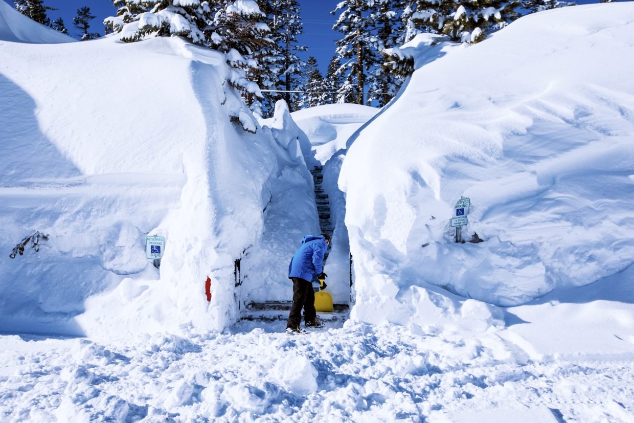
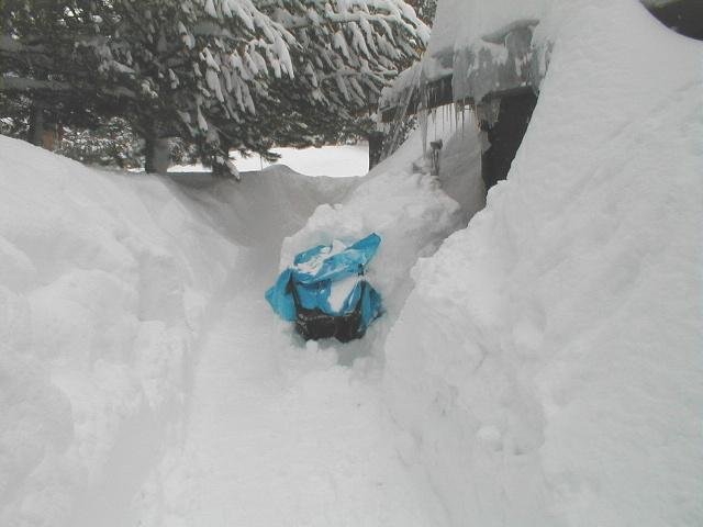
These pictures are all taken during mid winter, in January and February in the Eastern Sierra of California in the communities of South Lake Tahoe, Truckee, Tahoe City and Mammoth Lakes. Many people might argue and say while that IS a lot of snow those locations are up in the mountains. Yes it is true that these towns are up in the higher elevations, Truckee is at 6,030 feet, South Lake Tahoe and Tahoe City at 6,360 feet and Mammoth Lakes at 7,860 feet, keep in mind that these towns are also about 1000 miles further south than our location here in North Idaho and Northwest Montana. These pictures are from some of the heavier winters but not necessarily record breaking. Keep in mind as well that people live, work and go to school every day just like we do in our communities in North Idaho and Northwest Montana and the residential areas are at the same elevation as the towns themselves for the most part. The average annual snowfall for these towns is 202 inches for Truckee, 180 inches for South Lake Tahoe, 191 inches for Tahoe City and 206 inches for Mammoth Lakes (source NOAA CO-OP sites). I will also add that Valdez, Alaska is the snowiest city in the US averaging 292 inches of snow a year. Below are some historical photographs of the heaviest snowfall years on record for Sandpoint, ID and Libby, MT.
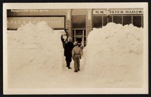
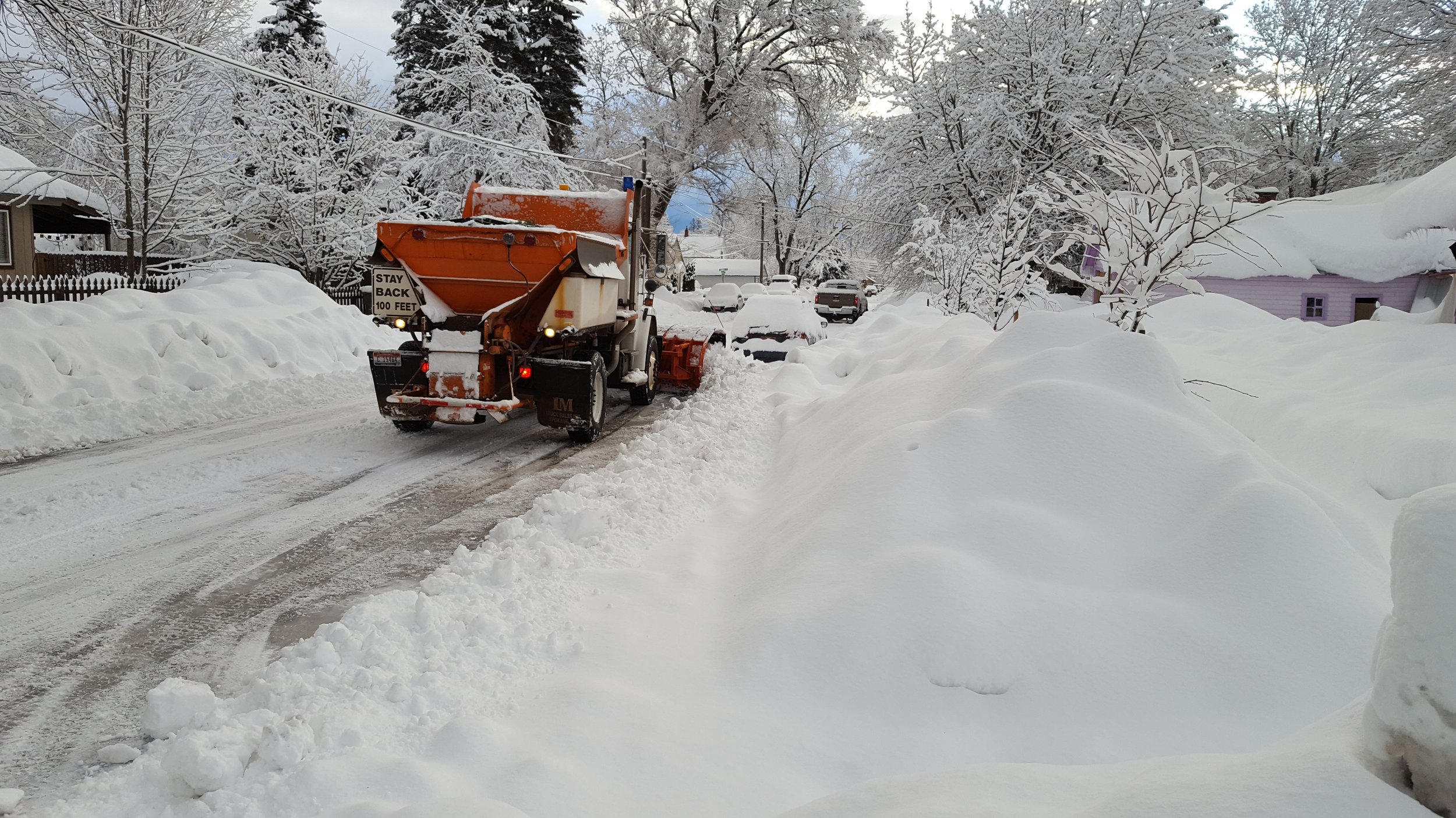
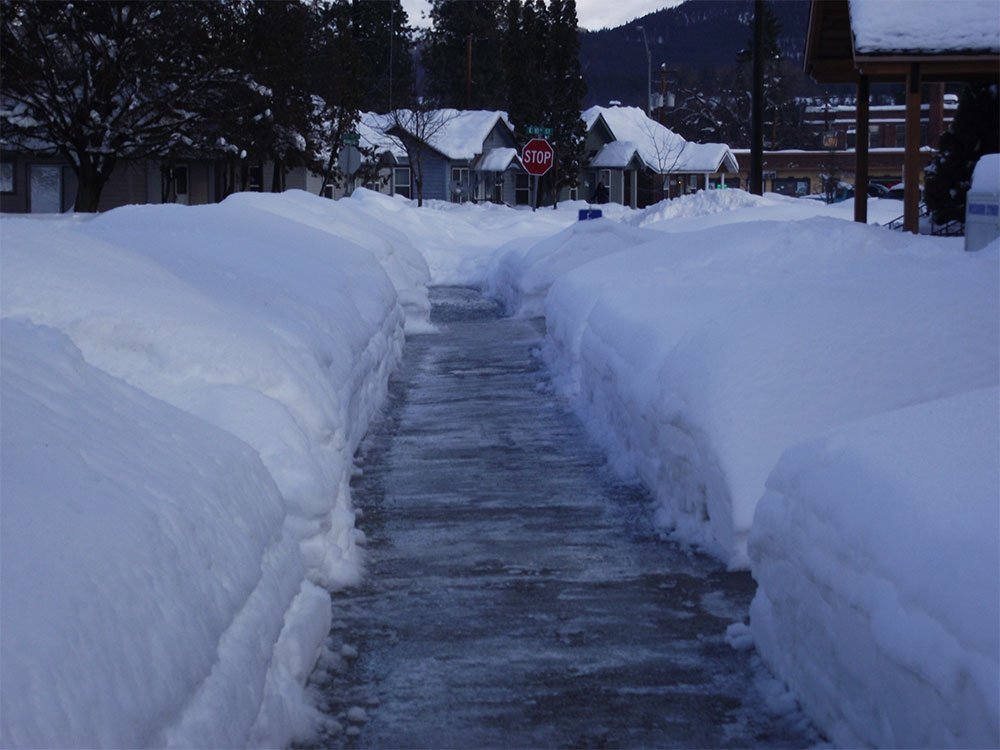
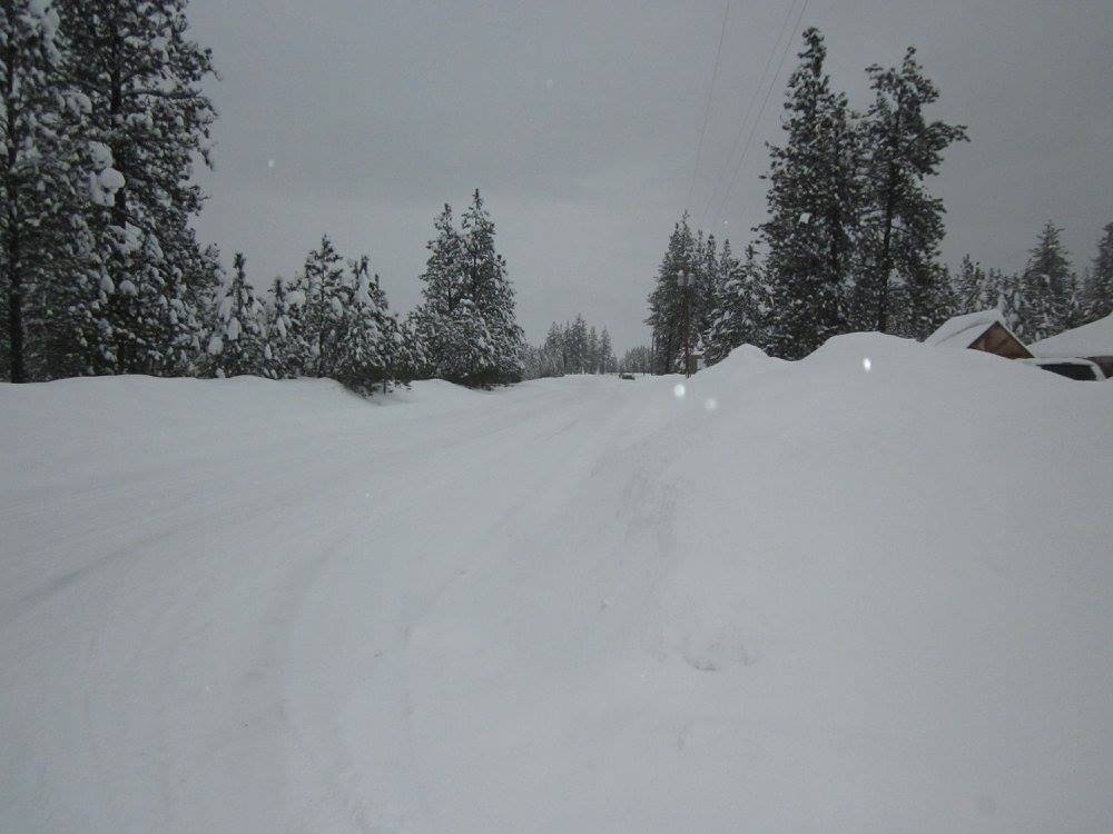
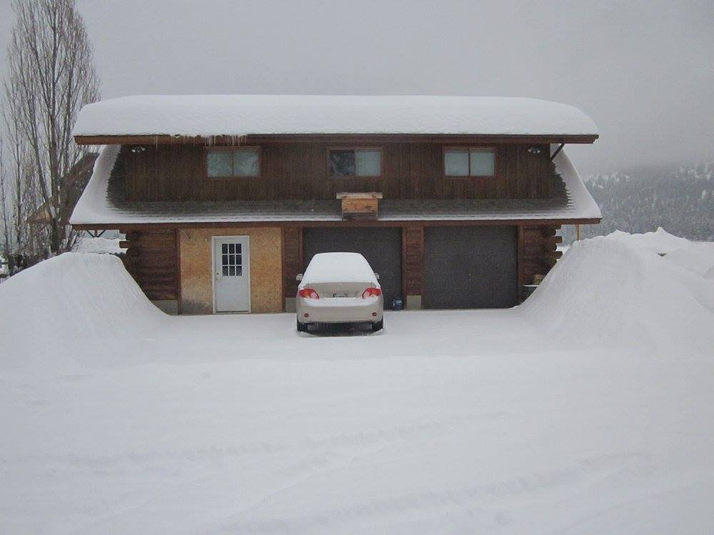
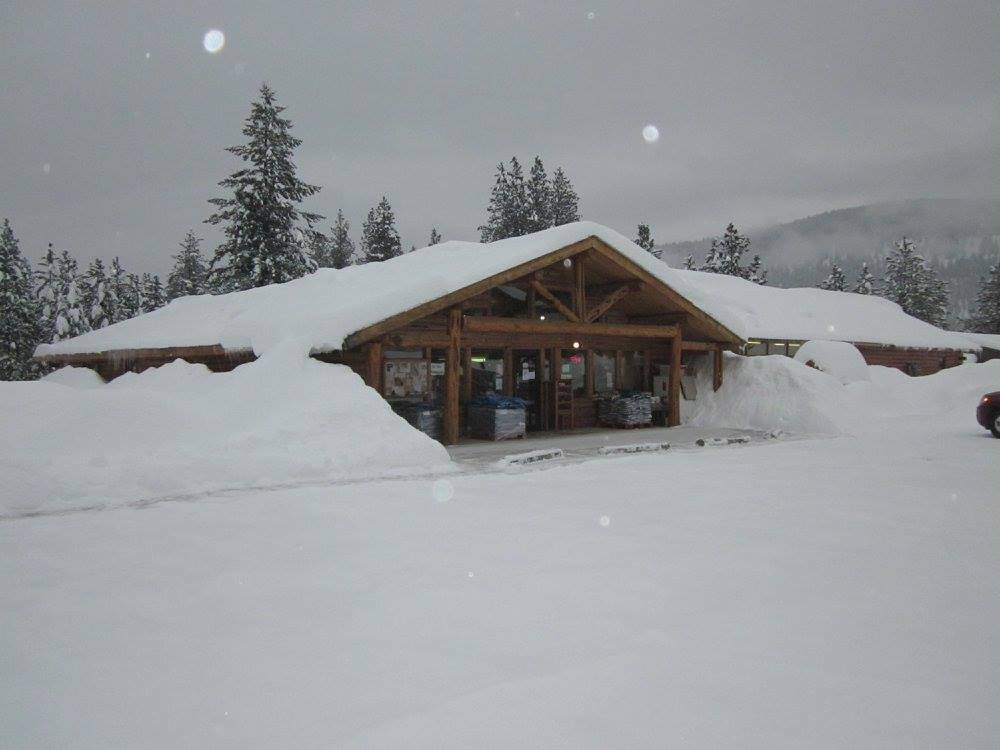
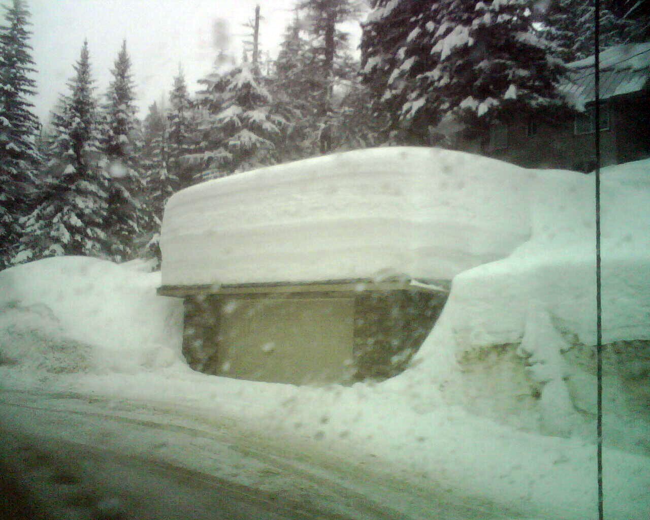
These pictures at first glance look very impressive and I do not want to take away from the amount of snow in these pictures. As the old saying goes, a picture can speak a thousand words. Look closely however at these pictures. The first one in Sandpoint, ID city center looks like a lot of snow, and it is, however that snow is piled up on either side so people can walk into the business. In reality the actual undisturbed snow depth there is about 40 inches or 3 1/2 feet. The second photograph from Sandpoint also looks impressive, however again if you look closer, you will see that the snow on the sides of the road is actually snow berms generated by both the plows and people shoveling their walkways. The 3rd photograph of Libby, MT is a bit more impressive as most of that snow is settled on the ground but is about 30 inches deep for the actual settled snow base. The 4th photo shows berms and is a bit difficult to tell the actual snow depth but it was around 28 inches on this date or 2 1/2 feet. The next 2 pictures are a bit misleading as the snow appears much deeper because it has been plowed and piled up both on the side of the road and the parking lot on the other side with the picture of my former home in Libby the snow I had piled up on either side of my driveway. In these pictures the settled snow depth is actually 32 inches or just shy of 3 feet. The 7th and 8th pictures are also a bit misleading as they show snow that has slid off the roof of the building as well as snow that has been piled up to clear the entrance to the store while the other photo again shows a berm both from the plows on the road and the parking lot. The 9th picture of Sandpoint, ID was taken in January of 2008 with an actual settled snow depth of 34 inches. The last picture, certainly the most impressive of all of them is certainly a lot of snow but this is taken up at Schweitzer Ski Area at an elevation of 4000 feet or a little less than 2000 feet higher than the town of Sandpoint, ID which sits at 2,126 feet and Libby which sits at 2,060 feet. The difference is that while a few people do stay year round up at Schweitzer, most people do not live there and must travel down to the town of Sandpoint which sits 9 miles away and much lower with much less snowfall. Still those that choose to live up in Schweitzer Village have a lot more work to do than the rest of us “down here.” Also remember that the deepest settled snow depth ever recorded in our region on the valley floors is 55 inches in Bonners Ferry, ID while the deepest recorded settled snow depth in Lake Tahoe in town is 182 inches! I personally on multiple occasions when I was the CO-OP observer for South Lake Tahoe measured a settled snow depth in excess of 60 inches which is over 5 feet deep!
So why do locations such as Lake Tahoe, Mammoth receive so much more snow than we do here in North Idaho and Northwest Montana? One can argue that up here the frequency of storms is much greater and we are much further north and often in the direct path of the North Pacific storm track. These are all correct statements. There are 2 main reasons as to why our region gets far less snow than the snowiest locations in the lower 48 states. The first being our location. While we are in the direct path of the North Pacific storm track we are also downwind of the Cascade Mountains which, because of their high elevation, takes a large amount of the available moisture and lift away from our region both in the Selkirk Mountains and the Cabinet Mountains. While these mountains still see much higher snowfall amounts than the surrounding areas, they receive far less amounts of snowfall than the same locations in the Cascades and the Sierra Nevada at the same elevations. Take a look at the rather basic picture below.

This is a very basic, textbook picture of the Cascade rain shadow and in truth the precipitation does extend farther down the “dry leeward slope” than as depicted in this picture but the effect for our region is the same. We are actually in the region of the Cascade Rain Shadow although still on the windward (westward) side of the Continental Divide which is the spine of the Rocky Mountains. Because we are on the windward side our region sees much more precipitation than the dry Columbia basin and even the Northern Washington Mountain ranges such as the Kettle Range. The Coastal Range west of the Sierra Nevada and Cascades is much lower than the Washington Cascades and therefore does not block any of the Pacific Moisture that crosses them from impacting the Sierra or the Cascades. With most of our moisture coming from the west and a milder source region, our storms also tend to be a bit warmer which leads to the second reason our region sees less snowfall than our counterparts to the south.
Elevation is the other main factor most valleys across Northwest Montana and North Idaho see far less snowfall than the communities further south. While the elevation of most of our valleys is around 2000 feet above sea level give or take a few hundred feet this elevation is overall not high enough to keep most of the winter precipitation as snow with a largely back and forth between rain and snow in our valleys. Even if most of our precipitation dropped into the region from Canada those types of storm systems typically lack the convergence and moisture source that Pacific storm systems possess. While they often are very dynamic and certainly much colder than their Pacific counterparts they generally move through rather quickly and bring brief but intense bursts of snowfall but as quickly as they move in, they usually move out. There is actually a lot more that can be said as to why our region does not receive the mammoth snowfall amounts that the snowier regions in the country get but this is more of a basic article on the subject and also to show that the myths of snow being so deep it would bury homes in the winter in this region is simply not true. If snow did get that deep around here, all the buildings would collapse as the building codes are not up to par for handling the amounts of snow in the pictures listed at the top. In the 11 years I spent living in both Tahoe and Mammoth, we never shoveled the roof and most people did not shovel roofs because the building codes were much stricter and homes and businesses had to be able to handle a much heavier snow load because of the large amounts of snowfall that fell each winter.
A couple more final facts that many people overlook or do not consider when considering how much snowfall a region receives. Regions that receive large amounts of snow, both here and elsewhere, will have “snow stakes” or “snow poles” along the sides of their roads to help snowplow drivers know where the edge of the road or right of way ends for each road. Because snow depths in these locations get so deep it becomes extremely difficult to be able to differentiate how wide a road needs to be plowed in addition to helping snow removal operators avoid potential hazards that may be buried by deep snows. Throughout both towns around Lake Tahoe and Mammoth Lakes as well as up around Schweitzer and over Lookout Pass 15 to 20 foot snow poles line the roadways in these locations because of the large snowfalls that occur. We do have some reflector snow poles in the valleys along the state highways down where people live but once in any of the towns in both North Idaho and Northwest Montana those markers are largely absent along the sides of the roadways simply because they are not necessary due to the overall lack of snowfalls. Another fact that is often overlooked in stating snowfall amounts is the vegetation types that grow in our region verses those that see very large amounts of snowfall. In our area we have an abundance of Douglas Fir, Ponderosa Pine and Grand Fir for our evergreens. These tree species are most commonly found in lower elevations that have a fair amount of precipitation but not large amounts of snowfall as the branches of these trees, with the exception of the Ponderosa Pines, simply cannot handle large and heavy snow loads. When you travel up to Schweitzer or over Lookout Pass the trees that grow in this region are Sub-Alpine Fir, Engleman Spruce, Limber Pine and Lodgepole Pine. These trees only grow in areas with large snowfall amounts. Further south across the Eastern Sierra, Sub-Alpine Fir and Engleman Spruce are replaced by Red Fir, White Fir, Jeffrey Pine and Lodgepole Pine which all grow mainly in areas that receive in excess of 200 inches of snowfall throughout the winter. If our region did historically see frequent large snowfalls each year, as many long time locals will say, then our forest types would not be what they are now as our trees would simply not be able to handle those incredible amounts of snow that are referenced. In addition, anyone that has driven over Snoqualmie or Stevens Passes in the Washington Cascades has seen the enormous amounts of snow that falls in these regions. The forests at these locations are largely Sub-Alpine Fir, Mountain Hemlock and Nobel Fir (the northern cousin of Red Fir). There are also very large snow reflector poles lining the road at these passes. Hope this helps to clear things up and if nothing else, gives some nice pictures to look at.